A cold war map showing the Berlin Wall as a bricked-up barrier and barbed wire surrounding West Berlin. Airports, government buildings, factories and other sites are shown in the West, but none in the East. Detailed explanations of transportation, borders and border crossing are provided in German, English, French and Spanish - but not in Russian.
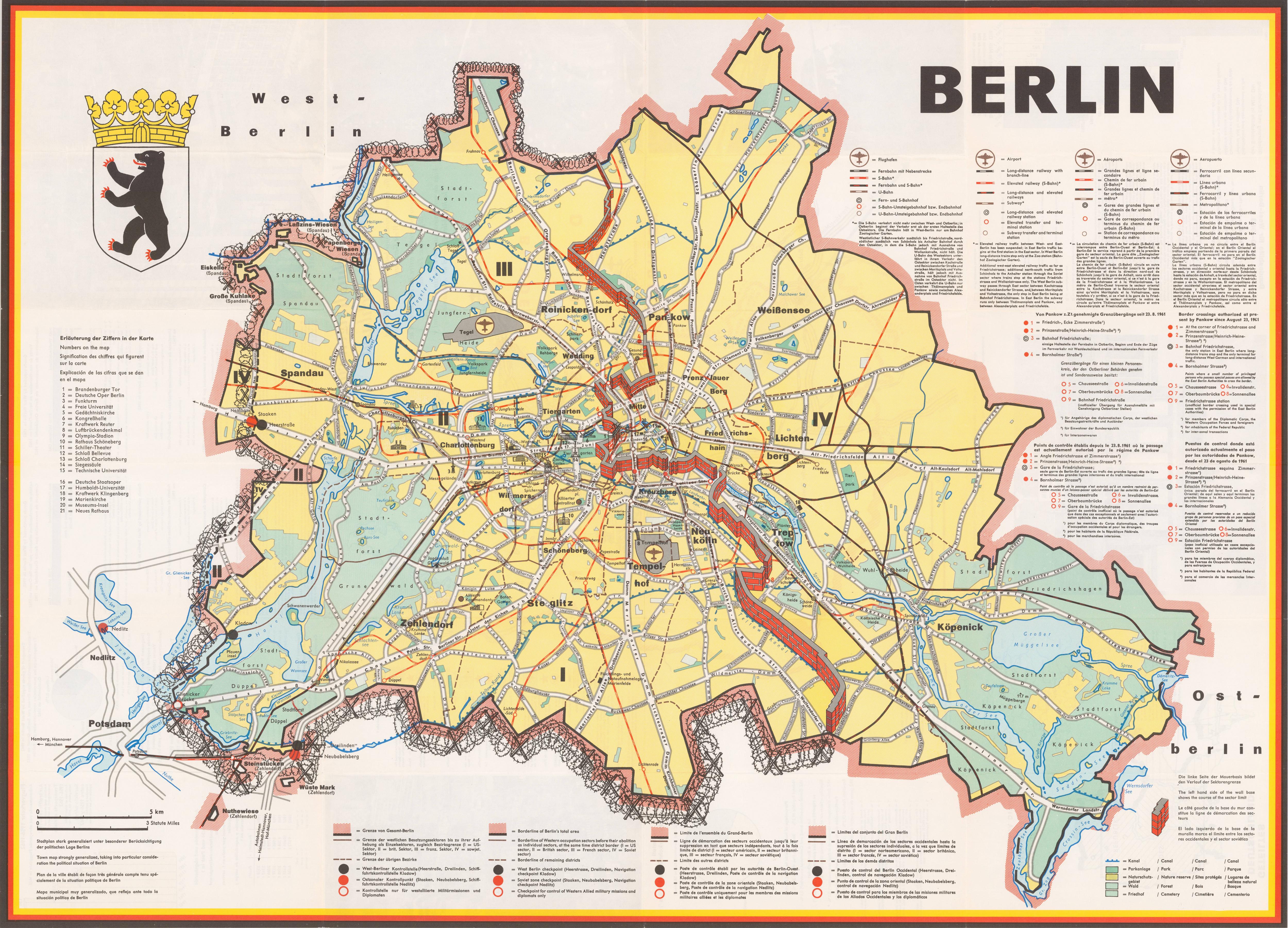
The map was published by the Press and Information Office of the State of Berlin, probably in 1963. Among other uses, these maps were distributed by the United States Air Force Representative Berlin as part of the Air Force's 7350th Support Group "Tempelhof Central Airport Visitor's Kit," called "Welcome to BERLIN."
No comments:
Post a Comment