What is the International Date Line?

The International Date Line serves as the "line of demarcation" between two consecutive calendar dates.

The International Date Line, established in 1884, passes through the mid-Pacific Ocean and roughly follows a 180 degrees longitude north-south line on the Earth. It is located halfway round the world from the prime meridian—the zero degrees longitude established in Greenwich, England, in 1852.

The International Date Line functions as a “line of demarcation” separating two consecutive calendar dates. When you cross the date line, you become a time traveler of sorts! Cross to the west and it’s one day later; cross back and you’ve “gone back in time."

Despite its name, the International Date Line has no legal international status and countries are free to choose the dates that they observe. While the date line generally runs north to south from pole to pole, it zigzags around political borders such as eastern Russia and Alaska’s Aleutian Islands.

Source: NOAA's National Ocean Service: http://oceanservice.noaa.gov/facts/international-date-line.html

A Soil Profile

If you look in a soil pit or on a roadside cut, you will see various layers in the soil. These layers are called soil horizons. The arrangement of these horizons in a soil is known as a soil profile. Soil scientists, who are also called pedologists, observe and describe soil profiles and soil horizons to classify and interpret the soil for various uses.

Soil horizons differ in a number of easily seen soil properties such as color, texture, structure, and thickness. Other properties are less visible. Properties, such as chemical and mineral content, consistence, and reaction require special laboratory tests. All these properties are used to define types of soil horizons. 

Soil scientists use the capital letters O, A, B, C, and E to identify the master horizons, and lowercase letters for distinctions of these horizons. Most soils have three major horizons -- the surface horizon (A), the subsoil (B), and the substratum (C). Some soils have an organic horizon (O) on the surface, but this horizon can also be buried. The master horizon, E, is used for subsurface horizons that have a significant loss of minerals (eluviation). Hard bedrock, which is not soil, uses the letter R.

Source: USDA.

Geography's Techniques

As spatial interrelationships are key to this synoptic science, maps are a key tool. Classical cartography has been joined by a more modern approach to geographical analysis, computer-based geographic information systems (GIS).
In their study, geographers use four interrelated approaches:
  • Systematic — Groups geographical knowledge into categories that can be explored globally.
  • Regional — Examines systematic relationships between categories for a specific region or location on the planet.
  • Descriptive — Simply specifies the locations of features and populations.
  • Analytical — Asks why we find features and populations in a specific geographic area.

Critical geography

Critical geography takes a critical theory (Frankfurt School) approach to the study and analysis of geography. The development of critical geography can be seen as one of the four major turning points in the history of geography (the other three being environmental determinism, regional geography and quantitative revolution). Though post-positivist approaches remain important in geography the critical geography arose as a critique of positivism introduced by quantitative revolution.

Two main schools of thought emerged from human geography and one existing school (behavioural geography) which made a brief comeback. Behavioural geography sought to counter the perceived tendency of quantitative geography to deal with humanity as a statistical phenomenon. It flourished briefly during the 1970s and sought to provide a greater understanding of how people perceived places and made locational decisions and sought to challenge mathematical models of society, in particular the use of econometric techniques. But the lack of a sound theoretical base left behavioural geography open to critique as merely descriptive and amounting to little more than a listing of spatial preferences.

Radical geography emerged during the 1970s and 1980s as the inadequacies of behavioralist methods became clear. It sought to counter the positivist quantitative methods with normative techniques drawn from Marxist theory: quantitative methods, it argued, were not useful unless alternatives or solutions were given to problems.

The final and, arguably, most successful of the three schools was humanistic geography, initially formed part of behavioural geography but fundamentally disagreed with the use of quantitative methods in assessing human behaviour and thoughts in favour of qualitative analysis. Humanistic geography used many of the techniques that the humanities use such as source analysis and the use of text and literature to try to ‘get into the mind’ of the subject(s). Furthermore, Cultural geography revived due to humanistic geography and new areas of study such as Feminist geography, postmodernist and poststructuralist geography began to emerge.

Regional geography

Regional geography is the study of world regions. Attention is paid to unique characteristics of a particular region such as natural elements, human elements, and regionalization which covers the techniques of delineating space into regions.

Regional geography is also a certain approach to geographical study, comparable to quantitative geography or critical geography. This approach prevailed during the second half of the 19th century and the first half of the 20th century, a period when then regional geography paradigm was central within the geographical sciences. It was later criticised for its descriptiveness and the lack of theory. Strong criticism was leveled against it in particular during the 1950s and the quantitative revolution. Main critics were G. H. T. Kimble and Fred K. Schaefer.

The regional geography paradigm has had an impact on many other geographical sciences, including economic geography and geomorphology. Regional geography is still taught in some universities as a study of the major regions of the world, such as Northern and Latin America, Europe, and Asia and their countries. In addition, the notion of a city-regional approach to the study of geography gained some credence in the mid-1990s through the work of geographers such as Saskia Sassen, although it was also criticized, for example by Michael Storper.

Notable figures in regional geography were Alfred Hettner in Germany, with his concept of chorology; Paul Vidal de la Blache in France, with the possibilism approach (possibilism being a softer notion than environmental determinism); and, in the United States, Richard Hartshorne with his concept of areal differentiation.

Some geographers have also attempted to reintroduce a certain amount of regionalism since the 1980s. This involves a complex definition of regions and their interactions with other scales.

See also: Geography.

Geographer

A geographer is a scholar whose area of study is geography, the study of Earth's natural environment and human society.

Although geographers are historically known as people who make maps, map making is actually the field of study of cartography, a subset of geography. Geographers do not study only the details of the natural environment or human society, but they also study the reciprocal relationship between these two. For example, they study how the natural environment contributes to the human society and how the human society affects the natural environment.
The Geographer (1668-69), by Johannes Vermeer.

In particular, physical geographers study the natural environment while human geographers study human society. Modern geographers are the primary practitioners of the GIS (geographic information system), who are often employed by local, state, and federal government agencies as well as in the private sector by environmental and engineering firms.

There is a well-known painting by Johannes Vermeer titled The Geographer, which is often linked to Vermeer's The Astronomer. These paintings are both thought to represent the growing influence and rise in prominence of scientific enquiry in Europe at the time of their painting, 1668–69.

Areas of study
There are three major fields of study, which are further subdivided:
  • Physical geography: including geomorphology, hydrology, glaciology, biogeography, climatology, meteorology, pedology, oceanography, geodesy, and environmental geography. 
  • Human geography: including urban geography, cultural geography, economic geography, political geography, historical geography, marketing geography, health geography, and social geography. 
  • Regional geography: including atmosphere, biosphere, and lithosphere.
The National Geographic Society identifies five broad key themes for geographers:
  • location 
  • place 
  • human-environment interaction 
  • movement 
  • regions
See also: Geography.

Integrated geography

Integrated geography (also, integrative geography, environmental geography or human–environment geography) is the branch of geography that describes and explains the spatial aspects of interactions between human individuals or societies and their natural environment, called coupled human–environment systems.

Origins
It requires an understanding of the dynamics of physical geography, as well as the ways in which human societies conceptualize the environment (human geography). Thus, to a certain degree, it may be seen as a successor of Physische Anthropogeographie (English: "physical anthropogeography")—a term coined by University of Vienna geographer Albrecht Penck in 1924 —and geographical cultural or human ecology (Harlan H. Barrows 1923). Integrated geography in the United States is principally influenced by the schools of Carl O. Sauer (Berkeley), whose perspective was rather historical, and Gilbert F. White (Chicago), who developed a more applied view.

Focus
The links between human and physical geography were once more readily apparent than they are today. As human experience of the world is increasingly mediated by technology, the relationships have often become obscured. Thereby, integrated geography represents a critically important set of analytical tools for assessing the impact of human presence on the environment by measuring the result of human activity on natural landforms and cycles. It hence is considered the third branch of geography, as compared to physical and human geography.

See also: Geography.

History of Geography

The history of Geography


The oldest known world maps date back to ancient Babylon from the 9th century BC. The best known Babylonian world map, however, is the Imago Mundi of 600 BC. The map as reconstructed by Eckhard Unger shows Babylon on the Euphrates, surrounded by a circular landmass showing Assyria, Urartu and several cities, in turn surrounded by a "bitter river" (Oceanus), with seven islands arranged around it so as to form a seven-pointed star. The accompanying text mentions seven outer regions beyond the encircling ocean. The descriptions of five of them have survived. In contrast to the Imago Mundi, an earlier Babylonian world map dating back to the 9th century BC depicted Babylon as being further north from the center of the world, though it is not certain what that center was supposed to represent.
The Ptolemy world map, reconstituted from Ptolemy's Geographia, written c. 150.
The ideas of Anaximander (c. 610 BC-c. 545 BC): considered by later Greek writers to be the true founder of geography, come to us through fragments quoted by his successors. Anaximander is credited with the invention of the gnomon, the simple, yet efficient Greek instrument that allowed the early measurement of latitude. Thales is also credited with the prediction of eclipses. The foundations of geography can be traced to the ancient cultures, such as the ancient, medieval, and early modern Chinese. The Greeks, who were the first to explore geography as both art and science, achieved this through Cartography, Philosophy, and Literature, or through Mathematics. There is some debate about who was the first person to assert that the Earth is spherical in shape, with the credit going either to Parmenides or Pythagoras. Anaxagoras was able to demonstrate that the profile of the Earth was circular by explaining eclipses. However, he still believed that the Earth was a flat disk, as did many of his contemporaries. One of the first estimates of the radius of the Earth was made by Eratosthenes.

The first rigorous system of latitude and longitude lines is credited to Hipparchus. He employed a sexagesimal system that was derived from Babylonian mathematics. The meridians were sub-divided into 360°, with each degree further subdivided 60′ (minutes). To measure the longitude at different location on Earth, he suggested using eclipses to determine the relative difference in time. The extensive mapping by the Romans as they explored new lands would later provide a high level of information for Ptolemy to construct detailed atlases. He extended the work of Hipparchus, using a grid system on his maps and adopting a length of 56.5 miles for a degree.

From the 3rd century onwards, Chinese methods of geographical study and writing of geographical literature became much more complex than what was found in Europe at the time (until the 13th century). Chinese geographers such as Liu An, Pei Xiu, Jia Dan, Shen Kuo, Fan Chengda, Zhou Daguan, and Xu Xiake wrote important treatises, yet by the 17th century advanced ideas and methods of Western-style geography were adopted in China.

During the Middle Ages, the fall of the Roman empire led to a shift in the evolution of geography from Europe to the Islamic world. Muslim geographers such as Muhammad al-Idrisi produced detailed world maps (such as Tabula Rogeriana), while other geographers such as Yaqut al-Hamawi, Abu Rayhan Biruni, Ibn Battuta, and Ibn Khaldun provided detailed accounts of their journeys and the geography of the regions they visited. Turkish geographer, Mahmud al-Kashgari drew a world map on a linguistic basis, and later so did Piri Reis (Piri Reis map). Further, Islamic scholars translated and interpreted the earlier works of the Romans and the Greeks and established the House of Wisdom in Baghdad for this purpose. Abū Zayd al-Balkhī, originally from Balkh, founded the "Balkhī school" of terrestrial mapping in Baghdad. Suhrāb, a late tenth century Muslim geographer accompanied a book of geographical coordinates, with instructions for making a rectangular world map with equirectangular projection or cylindrical equidistant projection.

Abu Rayhan Biruni (976-1048) first described a polar equi-azimuthal equidistant projection of the celestial sphere. He was regarded as the most skilled when it came to mapping cities and measuring the distances between them, which he did for many cities in the Middle East and the Indian subcontinent. He often combined astronomical readings and mathematical equations, in order to develop methods of pin-pointing locations by recording degrees of latitudeand longitude. He also developed similar techniques when it came to measuring the heights of mountains, depths of the valleys, and expanse of the horizon. He also discussed human geography and the planetary habitability of the Earth. He also calculated the latitude of Kath, Khwarezm, using the maximum altitude of the Sun, and solved a complexgeodesic equation in order to accurately compute the Earth's circumference, which were close to modern values of the Earth's circumference. His estimate of 6,339.9 km for the Earth radius was only 16.8 km less than the modern value of 6,356.7 km. In contrast to his predecessors, who measured the Earth's circumference by sighting the Sun simultaneously from two different locations, al-Biruni developed a new method of using trigonometric calculations, based on the angle between a plain and mountain top, which yielded more accurate measurements of the Earth's circumference, and made it possible for it to be measured by a single person from a single location.

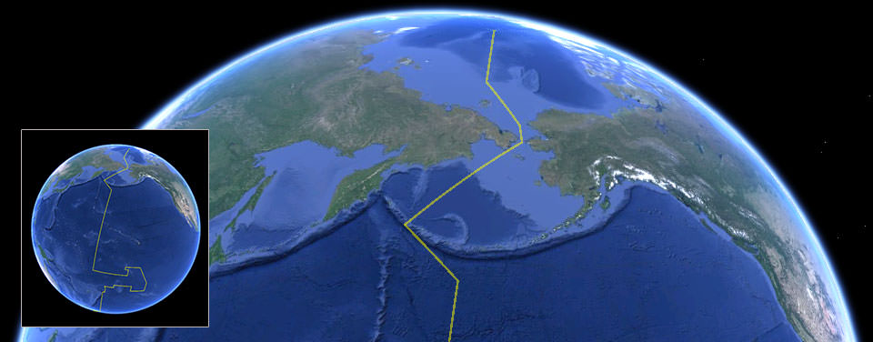
The European Age of Discovery during the 16th and the 17th centuries, where many new lands were discovered and accounts by European explorers such as Christopher Columbus, Marco Polo, and James Cook revived a desire for both accurate geographic detail, and more solid theoretical foundations in Europe. The problem facing both explorers and geographers was finding the latitude and longitude of a geographic location. The problem of latitude was solved long ago but that of longitude remained; agreeing on what zero meridian should be was only part of the problem. It was left to John Harrison to solve it by inventing the chronometer H-4 in 1760, and later in 1884 for the International Meridian Conference to adopt by convention the Greenwich meridian as zero meridian.

The 18th and the 19th centuries were the times when geography became recognized as a discrete academic discipline, and became part of a typical university curriculum in Europe (especially Paris and Berlin). The development of many geographic societies also occurred during the 19th century, with the foundations of the Société de Géographie in 1821, the Royal Geographical Society in 1830, Russian Geographical Society in 1845, American Geographical Society in 1851, and the National Geographic Society in 1888. The influence of Immanuel Kant, Alexander von Humboldt, Carl Ritter, and Paul Vidal de la Blache can be seen as a major turning point in geography from a philosophy to an academic subject.
Over the past two centuries, the advancements in technology with computers have led to the development of geomatics. and new practices such as participant observation and geostatistics being incorporated into geography's portfolio of tools. In the West during the 20th century, the discipline of geography went through four major phases: environmental determinism, regional geography, the quantitative revolution, and critical geography. The strong interdisciplinary links between geography and the sciences of geology and botany, as well as economics, sociology and demographics have also grown greatly, especially as a result of Earth System Science that seeks to understand the world in a holistic view.

United States Flag Coloring Page

United States Flag Coloring Page

Vermont State Flag Coloring Page

Vermont State Flag Coloring Page

Alaska State Flag Coloring Page

Alaska State Flag Coloring Page

Oregon State Flag Coloring Page

Oregon State Flag Coloring Page

Tennessee State Flag Coloring Page

Tennessee State Flag Coloring Page

South Carolina State Flag Coloring Page

South Carolina State Flag Coloring Page

Minnesota State Flag Coloring Page

Minnesota State Flag Coloring Page

Alabama State Flag Coloring Page

Alabama State Flag Coloring Page

Washington Flag Coloring Page

Washington Flag Coloring Page

Virginia Flag Coloring Page

 Virginia Flag Coloring Page

Michigan Flag Coloring Page

Pennsylvania Flag Coloring Page

 Pennsylvania Flag Coloring Page

Illinois State Flag Coloring Page

Illinois State Flag Coloring Page

California’s State Seal

California’s State Seal - During the constitutional convention,a member named Caleb Lyonpresented a design for a state seal.The seal's design showed thesepictures to tell about ideas that wereimportant to California:
Great Seal of the State of California coloring page for printing.
Goddess Minerva - Minerva (Athenain Greek mythology) in Romanmythology was said to have been bornfrom the head of the god Jupiter intoa full-grown adult. She was includedto show California's quick rise tostatehood without first becoming aterritory like most other states.

Grizzly Bear - California's state animal

Prospector/Miner - The gold rush

Grain - Agriculture

Ships - Economic power and trade

Water - San Francisco Bay

Eureka - written across the top of thepicture and means "I found it". Madepopular during the gold rush becauseprospectors would shout it out whenthey found gold.

Tropic of Cancer? Tropic of Capricorn? Who came up with those names?

These names were thought up about 2,000 years ago. At that time, the Sun was in the direction of the constellation Cancer at the Summer Solstice in June. However, this is no longer true. Earth’s axis wobbles a bit, slowly changing the direction in which it points.
Over 26,000 years, the axis traces out a small cone shape. At this time, the Sun is in Taurus or Gemini (depending on where you draw the boundary between them) at the Summer Solstice. The word "tropic" itself comes from the Greek τροπή (tropi), meaning turn, referring to the fact that the sun appears to "turn back" at the solstices.
In this chart of the zodiac, the Sun is in the constellation Cancer.
When the Tropic of Capricorn was named, the Sun was entering the constellation Capricorn at the Winter Solstice in December. In modern times the Sun appears in the constellation Sagittarius during this time.

Source: Nasa

What is the Coriolis Effect?

A Powerful “Force”

It affects weather patterns, it affects ocean currents, and it even affects air travel. As important as the Coriolis Effect is, many have not heard about it, and even fewer understand it. In simple terms, the Coriolis Effect makes things (like planes or currents of air) traveling long distances around the Earth appear to move at a curve as opposed to a straight line.
The Coriolis Effect is named after French mathematician
and physicist Gaspard-Gustave de Coriolis.
It’s a pretty weird phenomenon, but the cause is simple: Different parts of the Earth move at different speeds.

What Do You Mean Parts of Earth Move at Different Speeds!?

Think about this: It takes the Earth 24 hours to rotate one time. If you are standing a foot to the right of the North or South Pole, that means it would take 24 hours to move in a circle that is about six feet in circumference. That’s about 0.00005 miles per hour.

Hop on down to the equator, though, and things are different. It still takes the Earth the same 24 hours to make a rotation, but this time we are traveling the entire circumference of the planet, which is about 25,000 miles long. That means you are traveling almost 1040 miles per hour just by standing there.
Shorter distance to travel in the same amount
of time means slower speeds closer to the poles.
So even though we are all on Earth, how far we are from the equator determines our forward speed. The farther we are from the equator, the slower we move.

Okay. So How Does That Prevent Things from Traveling in a Straight Line?

Good question! Now think about this: You are on a train traveling at top speed and you are passing a train that is moving a bit slower. You see, for some mysterious reason, that there is a soccer goal on this slower train. Always prepared, you happen to have a soccer ball handy and want to make an impressive trick shot.

You take an incredible shot directly at the goal when you are even with the slower train. Even though your aim is dead-on, the ball travels to the side and misses the net. That’s because the ball is traveling not only in the direction of the goal, but it is also going in the direction (and speed) of your train.
This is what happens with our attempted trick shot.
Let’s pretend these trains are the Earth at different latitudes and add another red train. Think of the two red trains as the northern and southern tropics and the blue train as the equator. The red trains are going slower than the blue train. Remember, the farther you go from the equator, the slower you move.

Now let’s put our trains on an actual Earth-shaped globe:
The trains still move at different speeds, but now
they would appear to travel parallel to each other.
Even though the red trains are going slower than the blue train, since they are traveling a shorter distance, they would appear from a bird’s-eye view to be going at the same speed. That doesn’t mean your trick shot would behave any differently though. From a bird’s-eye view, it would look like this:
A bird's eye view.
And that’s the deflection we are talking about! Anything traveling long distances, like air currents, ocean currents pushed by air, and airplanes, will all be deflected because of the Coriolis Effect! Weird, right?

Source: Nasa

What is a Planet?

Science is a dynamic process of questioning, hypothesizing, discovering, and changing previous ideas based on what is learned. Scientific ideas are developed through reasoning and tested against observations. Scientists assess and question each other's work in a critical process called peer review.
Illustration: Eris (left) and Ceres (lower center) compared to Earth and its moon.
Our understanding about the universe and our place in it has changed over time. New information can cause us to rethink what we know and reevaluate how we classify objects in order to better understand them. New ideas and perspectives can come from questioning a theory or seeing where a classification breaks down.
Now: Scaled views of our solar system.
Defining the term planet is important, because such definitions reflect our understanding of the origins, architecture, and evolution of our solar system. Over historical time, objects categorized as planets have changed. The ancient Greeks counted the Earth's moon and sun as planets along with Mercury,Venus, Mars, Jupiter, and Saturn. Earth was not considered a planet, but rather was thought to be the central object around which all the other celestial objects orbited. The first known model that placed the sun at the center of the known universe with the Earth revolving around it was presented by Aristarchus of Samos in the third century BCE, but it was not generally accepted. It wasn't until the 16th century that the idea was revived by Nicolaus Copernicus. By the 17th century, astronomers (aided by the invention of the telescope) realized that the sun was the celestial object around which all the planets - including Earth - orbit, and that the moon is not a planet, but a satellite (moon) of Earth. Uranus was added as a planet in 1781 and Neptune was discovered in 1846.

Ceres was discovered between Mars and Jupiter in 1801 and originally classified as a planet. But as many more objects were subsequently found in the same region, it was realized that Ceres was the first of a class of similar objects that were eventually termed asteroids (star-like) or minor planets.
Copernicus' theory of a sun-centered solar system was not accepted for decades.
Pluto, discovered in 1930, was identified as the ninth planet. But Pluto is much smaller than Mercury and is even smaller than some of the planetary moons. It is unlike the terrestrial planets (Mercury, Venus, Earth, Mars), or the gas giants (Jupiter, Saturn), or the ice giants (Uranus, Neptune). Charon, its huge satellite, is nearly half the size of Pluto and shares Pluto's orbit. Though Pluto kept its planetary status through the 1980s, things began to change in the 1990s with some new discoveries.

Technical advances in telescopes led to better observations and improved detection of very small, very distant objects. In the early 1990s, astronomers began finding numerous icy worlds orbiting the sun in a doughnut-shaped region called the Kuiper Belt beyond the orbit of Neptune - out in Pluto's realm. With the discovery of the Kuiper Belt and its thousands of icy bodies (known as Kuiper Belt objects, or KBOs; also called transneptunians), it was proposed that it is more useful to think of Pluto as the biggest KBO instead of a planet. Then, in 2005, a team of astronomers announced that they had found a tenth planet - it was a KBO even larger than Pluto. People began to wonder what planethood really means. Just what is a planet, anyway? Suddenly the answer to that question didn't seem so self-evident, and, as it turns out, there are plenty of disagreements about it.

The International Astronomical Union (IAU), a worldwide organization of astronomers, took on the challenge of classifying the newly found KBO (later named Eris). In 2006, the IAU passed a resolution that defined planet and established a new category, dwarf planet. Eris, Ceres, Pluto, and two more recently discovered KBOs named Haumea and Makemake, are the dwarf planets recognized by the IAU (as of July 2013). Pluto, Eris, Haumea, and Makemake are also classified as KBOs, and Ceres retains its asteroid label. There may be another 100 dwarf planets in the solar system and hundreds more in and just outside the Kuiper Belt.

Astronomers and planetary scientists did not unanimously agree with these definitions. To some it appeared that the classification scheme was designed to limit the number of planets; to others it was incomplete and the terms unclear. Some astronomers argued that location (context) is important, especially in understanding the formation and evolution of the solar system.
For thousands of years, people thought Earth was the center of the Universe.
One idea is to simply define a planet as a natural object in space that is massive enough for gravity to make it approximately spherical. But some scientists objected that this simple definition does not take into account what degree of measurable roundness is needed for an object to be considered round. In fact, it is often difficult to accurately determine the shapes of some distant objects. Others argue that where an object is located or what it is made of do matter and there should not be a concern with dynamics; that is, whether or not an object sweeps up or scatters away its immediate neighbors, or holds them in stable orbits. The lively planethood debate continues.

As our knowledge deepens and expands, the more complex and intriguing the universe appears. Researchers have found hundreds of extrasolar planets, or exoplanets, that reside outside our solar system; there may be billions of exoplanets in the Milky Way Galaxy alone, and some may be habitable (have conditions favorable to life). Whether our definitions of planet can be applied to these newly found objects remains to be seen.

Source: Nasa

Search This Blog